Measuring What the Earth Holds: Building the Technology Stack for Agricultural Carbon Verification
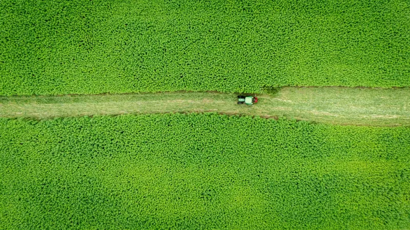
The promise of carbon farming is straightforward: American farmers who adopt regenerative practices—cover cropping, reduced tillage, diverse rotations—sequester additional carbon dioxide in their soils, and that sequestered carbon can be quantified, verified, and sold as credits to corporations seeking to offset their emissions. The economic opportunity is real. Carbon credit prices in voluntary markets have fluctuated between ten and fifty dollars per metric ton in recent years, and estimates of American agricultural land eligible for carbon programs run into the hundreds of millions of acres.
The obstacle is measurement. Carbon markets live or die on the credibility of their underlying data, and soil carbon is among the most difficult environmental variables to quantify at the spatial and temporal resolution that credible markets require. Soil organic carbon content varies significantly across distances of just a few feet, changes slowly over years, and can be influenced by weather, management decisions, and soil disturbance in ways that are difficult to disentangle from the sequestration signal a program is attempting to measure.
A cohort of well-funded agricultural technology startups—including Indigo Agriculture's carbon division, Yard Stick, Perennial, and Regrow Agriculture—is building the engineering infrastructure to solve this problem. Their technology choices will shape the economics of carbon farming for American producers for years to come.
The Spectroscopy Approach: Reading Carbon in the Field
Traditional soil carbon measurement relies on laboratory analysis of physical samples—a process that is accurate but expensive, slow, and logistically intensive. Collecting the sample density needed to characterize carbon stocks across a heterogeneous field with statistical confidence can cost hundreds of dollars per acre, a figure that renders direct measurement economically impractical at scale.
Visible and near-infrared spectroscopy offers a compelling alternative. When a beam of light across the electromagnetic spectrum is directed at a soil sample or, increasingly, at soil in situ, the pattern of wavelengths absorbed and reflected encodes information about the organic compounds present. Machine learning models trained on large libraries of paired spectral and laboratory data can translate those patterns into carbon concentration estimates with accuracy approaching that of conventional laboratory methods—at a fraction of the cost and time.
Companies such as Yard Stick have developed handheld and probe-mounted spectroscopy instruments designed for rapid field deployment. A technician can collect hundreds of spectral readings per day across a farm, building a dense spatial dataset that captures the natural variability of soil carbon distribution. Combined with GPS coordinates and soil classification maps, these readings feed into models that generate field-level carbon stock estimates with quantified uncertainty bounds.
The engineering challenge lies in calibration. Spectral signatures vary with soil moisture, texture, and mineralogy, meaning that a model trained on soils from the Midwest may perform poorly when deployed in the clay-heavy soils of the Southeast or the volcanic soils of the Pacific Northwest. Building calibration libraries that span the full diversity of American agricultural soils requires years of coordinated sampling effort and ongoing model refinement.
Satellites and Synthetic Aperture: The View from Above
Remote sensing from satellite platforms offers a complementary approach, particularly for monitoring changes in land management practices that influence carbon sequestration. Synthetic aperture radar and multispectral optical imagery can detect the presence of cover crops, residue cover, and tillage disturbance across entire landscapes at spatial resolutions now reaching sub-meter scales for commercial platforms.
Regrow Agriculture and similar companies have built analytical pipelines that ingest satellite imagery alongside historical weather data, soil survey information, and reported management practices to model carbon dynamics at the field level. These models do not measure soil carbon directly—they infer sequestration trajectories from observable proxies and validated agronomic relationships.
The advantage of satellite-based approaches is coverage. A single analytical platform can monitor millions of acres simultaneously, providing the scalability that carbon programs need to aggregate credits across large farmer networks. The limitation is that remote sensing cannot see below the soil surface; it must rely on relationships between observable surface conditions and subsurface carbon dynamics, relationships that introduce uncertainty into any credit estimate.
Addressing that uncertainty has become a central engineering priority. Companies are developing hybrid workflows that combine satellite monitoring for large-scale pattern detection with targeted physical sampling for ground truth validation—using the satellite data to direct sampling effort toward the highest-uncertainty locations rather than distributing samples uniformly across a field.
IoT Sensor Networks: Continuous Carbon Intelligence
A third technological strand involves deploying networks of in-soil sensors capable of providing continuous, real-time data on variables related to carbon cycling: soil moisture, temperature, CO₂ flux, and electrical conductivity. While no commercially available sensor directly measures soil organic carbon continuously, the combination of these proxy measurements fed into biogeochemical models can constrain estimates of carbon stock changes over time.
The engineering challenge for sensor networks is durability and data reliability. Agricultural soils are mechanically demanding environments—sensors must survive tillage equipment, freeze-thaw cycles, and years of biological activity. Wireless data transmission across rural landscapes with limited cellular infrastructure requires careful attention to network architecture, with mesh networking and low-power wide-area protocols such as LoRaWAN increasingly favored for their range and energy efficiency.
Data integrity is equally critical. Carbon credit buyers and auditing organizations need confidence that sensor readings have not been corrupted, manipulated, or interrupted. Several companies are exploring blockchain-based data provenance systems that create immutable records of sensor readings from collection through credit issuance, providing an auditable chain of custody that satisfies the verification requirements of major carbon standards organizations.
The Verification Problem and Market Trust
Underlying all of these engineering efforts is a market credibility problem. High-profile scrutiny of voluntary carbon markets—including investigative reporting questioning the permanence and additionality of various offset categories—has placed significant pressure on agricultural carbon programs to demonstrate rigorous, independently verifiable measurement.
The American Carbon Registry, Verra's Verified Carbon Standard, and other standards bodies have responded by tightening methodological requirements, demanding greater spatial sampling density, longer monitoring periods, and more explicit quantification of measurement uncertainty. These requirements are technically demanding and have the practical effect of raising the cost of credit issuance, which squeezes the economics of participation for smaller farm operations.
The startups building measurement technology are therefore engaged in a dual engineering challenge: making verification systems accurate enough to satisfy rigorous standards while keeping the cost of verification low enough that the economics remain workable for the American farmers the programs are designed to serve. The companies that solve both sides of that equation simultaneously will be positioned to define the infrastructure layer of agricultural carbon markets for the foreseeable future.